Stevensville, Maryland
Stevensville, Maryland | |
|---|---|
 Downtown Stevensville | |
 | |
| Coordinates: 38°58′52″N 76°19′8″W / 38.98111°N 76.31889°WCoordinates: 38°58′52″N 76°19′8″W / 38.98111°N 76.31889°W | |
| Country | United States |
| State | Maryland |
| County | Queen Anne's |
| Area | |
| • Total | 6.1 sq mi (15.9 km2) |
| • Land | 6.1 sq mi (15.9 km2) |
| • Water | 0.0 sq mi (0.0 km2) |
| Elevation | 7 ft (2 m) |
| Population (2000) | |
| • Total | 6,803 |
| • Density | 1,057.1/sq mi (408.1/km2) |
| Time zone | UTC−5 (Eastern (EST)) |
| • Summer (DST) | UTC−4 (EDT) |
| ZIP code | 21666 |
| Area code(s) | 410 |
| FIPS code | 24-75025 |
| GNIS feature ID | 0598122 |

Stevensville is a census-designated place (CDP) in Queen Anne's County, Maryland, United States, and is the county's most populous place among both CDPs and municipalities. The community is the eastern terminus of the Chesapeake Bay Bridge. The Stevensville Historic District is one of only two registered historic districts in the county, the other being the Centreville Historic District.
History[edit]
Stevensville was founded in 1850 as a steamboat terminal. Today, the Stevensville Historic District contains roughly 100 historic structures dating back to the town's early days.
In addition to the Stevensville Historic District, the Christ Church, Cray House, Friendship, Legg's Dependence, Mattapax, and Stevensville Bank are listed on the National Register of Historic Places.[1]
On July 24, 2017, an EF2 tornado hit Stevensville, causing damage to homes, trees, and power lines and injuring one person.[2]
Geography[edit]
Stevensville is located at 38°58′52″N 76°19′8″W / 38.98111°N 76.31889°W (38.981128, −76.318757).[3]
According to the United States Census Bureau, the CDP has a total area of 6.1 square miles (16 km2), all land.
Climate[edit]
The climate in this area is characterized by hot, humid summers and generally mild to cool winters. According to the Köppen Climate Classification system, Stevensville has a humid subtropical climate, abbreviated "Cfa" on climate maps.[4]
| Climate data for Stephenville, MD | |||||||||||||
|---|---|---|---|---|---|---|---|---|---|---|---|---|---|
| Month | Jan | Feb | Mar | Apr | May | Jun | Jul | Aug | Sep | Oct | Nov | Dec | Year |
| Average high °F (°C) | 42 (6) | 46 (8) | 53 (12) | 66 (19) | 74 (23) | 82 (28) | 86 (30) | 84 (29) | 78 (26) | 68 (20) | 56 (13) | 47 (8) | 65 (19) |
| Average low °F (°C) | 30 (−1) | 32 (0) | 38 (3) | 49 (9) | 58 (14) | 68 (20) | 72 (22) | 70 (21) | 64 (18) | 54 (12) | 42 (6) | 36 (2) | 51 (11) |
| Average precipitation inches (cm) | 2 (5.1) | 2.5 (6.4) | 3 (7.6) | 3.2 (8.1) | 3.2 (8.1) | 3.7 (9.4) | 4.9 (12) | 4.6 (12) | 4.4 (11) | 3.7 (9.4) | 2.5 (6.4) | 3 (7.6) | 40.7 (103.1) |
| Average snowfall inches (cm) | 3.8 (9.7) | 0.5 (1.3) | 0.5 (1.3) | 0 (0) | 0 (0) | 0 (0) | 0 (0) | 0 (0) | 0 (0) | 0 (0) | 0 (0) | 1 (2.5) | 5.8 (14.8) |
| Average snowy days | 1 | 0 | 0 | 0 | 0 | 0 | 0 | 0 | 0 | 0 | 0.1 | 1 | 2.1 |
| Source: NOAA[5] | |||||||||||||
Demographics[edit]
As of the census[6] of 2010, there were 6,803 people and 2,644 households residing in the CDP. The population density was 1,057.1 people per square mile. The racial makeup of the CDP was 93.81% White, 2.32% African American, 0.28% American Indian, 1.57% Asian, 0.73% from other races, and 1.57% from two or more races. Hispanic or Latino of any race accounted for 2.85% of the population.
_5.jpg)
Of 2,396 occupied households, 77.4% had children under the age of 18 living with them, 63.4% were married couples living together, 9.6% had a female householder with no husband present, and 22.6% were non-families. 16.7% of all households were made up of individuals, and 5.1% had someone living alone who was 65 years of age or older. The average household size was 2.84 and the average family size was 3.21.
In the CDP, the population was spread out, with 27.5% under the age of 18, 7.5% from 18 to 24, 26.9% from 25 to 44, 30% from 45 to 64, and 8.1% who were 65 years of age or older. The median age was 39.4 years. For every 100 females, there were 100.8 males.
The American Community Survey estimated the median income for a household in the CDP was $105,023 in 2018 U.S. dollars, and the median income for a family was $107,169.[7] Male householders with no wife present had a median income of $83,389 versus $78,281 for female householders with no husbands present. The per capita income for the CDP was $40,292.[8] About 1.6% of families[9] and 4.3% of the population were below the poverty line, including 0.8% of those under age 18 and 4.5% of those age 65 or over.[10]
Notable people[edit]
- Frank E. Petersen, first African-American Marine Corps aviator and the first African-American Marine Corps general
- Brock Adams, former United States Secretary of Transportation and United States senator from Washington
- Edward "E.J." Pipkin, Former Maryland state senator
- Frank Kratovil, former U.S. congressman
- Paul Reed Smith, luthier, founder of PRS Guitars
- Luke Kleintank, actor, most notable for Bones (TV series) and The Man in the High Castle (TV series)
Aviation[edit]
- Bay Bridge Airport (W29) is a small, county owned, public landing strip in Stevensville, overlooking the Chesapeake Bay Bridge. Many private airplanes take off and land there every day.[11]
- Kentmorr Airpark (3W3) is a small airpark community adjacent to Kentmorr Marina.
References[edit]
- ^ "National Register Information System". National Register of Historic Places. National Park Service. July 9, 2010.
- ^ "Updated: Queen Anne's County Tornado Confirmed". Salisbury, MD: WBOC-TV. July 24, 2017. Retrieved July 25, 2017.
- ^ "US Gazetteer files: 2010, 2000, and 1990". United States Census Bureau. 2011-02-12. Retrieved 2011-04-23.
- ^ Climate Summary for Stevensville, Maryland
- ^ "Stephensville,MD". March 2021. Retrieved 22 March 2021.
- ^ "U.S. Census: Maryland 2010: Summary Population and Housing Characteristics: 2010 Census of Population and Housing" (PDF). United States Census Bureau.
- ^ data.census.gov https://data.census.gov/cedsci/table?q=stevensville,%20md&g=1600000US2475025&hidePreview=false&tid=ACSST5Y2018.S1901&vintage=2018&layer=VT_2018_160_00_PY_D1&cid=DP05_0001E&t=Income%20(Households,%20Families,%20Individuals):Income%20and%20Poverty. Retrieved 2020-04-15. Missing or empty
|title=(help) - ^ data.census.gov https://data.census.gov/cedsci/table?q=stevensville,%20md&g=1600000US2475025&hidePreview=false&tid=ACSST5Y2018.S1902&vintage=2018&layer=VT_2018_160_00_PY_D1&cid=DP05_0001E&t=Income%20(Households,%20Families,%20Individuals):Income%20and%20Poverty. Retrieved 2020-04-15. Missing or empty
|title=(help) - ^ data.census.gov https://data.census.gov/cedsci/table?q=stevensville,%20md%20poverty%20line&g=1600000US2475025&tid=ACSST5Y2018.S1702&t=Poverty&layer=VT_2018_160_00_PY_D1&vintage=2018. Retrieved 2020-04-15. Missing or empty
|title=(help) - ^ data.census.gov https://data.census.gov/cedsci/table?q=stevensville,%20md%20poverty%20line&g=1600000US2475025&tid=ACSST5Y2018.S1701&t=Poverty&layer=VT_2018_160_00_PY_D1&vintage=2018. Retrieved 2020-04-15. Missing or empty
|title=(help) - ^ Bay Bridge Airport
Municipalities and communities of Queen Anne's County, Maryland, United States | ||
|---|---|---|
| Towns | 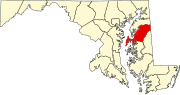 | |
| CDPs | ||
| Other communities | ||
| Footnotes | ‡This populated place also has portions in an adjacent county or counties | |
| General | |
|---|---|
| National libraries | |


