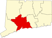
Woodmont, Connecticut
Woodmont, Connecticut | |
|---|---|
 U.S. Census Map | |
| Coordinates: 41°13′41″N 72°59′32″W / 41.22806°N 72.99222°W | |
| Country | United States |
| State | Connecticut |
| County | New Haven |
| Metropolitan area | New Haven |
| Area | |
| • Total | 0.99 sq mi (2.58 km2) |
| • Land | 0.28 sq mi (0.71 km2) |
| • Water | 0.72 sq mi (1.86 km2) |
| Elevation | 39 ft (12 m) |
| Population (2010) | |
| • Total | 1,488 |
| • Estimate (2019)[2] | 1,552 |
| • Density | 5,643.64/sq mi (2,182.43/km2) |
| Time zone | UTC-5 (EST) |
| • Summer (DST) | UTC-4 (EDT) |
| FIPS code | 09-88050 |
| GNIS feature ID | 0212247 |
| Website | www |
Woodmont is a borough of the city of Milford, in New Haven County, Connecticut. The population was 1,488 at the 2010 census.[3] It was first created by Special Act of Connecticut General Assembly in 1893 as the Woodmont Improvement Association.[4] In 1903 it became the Woodmont Association.[5] It became a municipality in 1957 when the Connecticut General Assembly passed House Bill No. 2443 "An Act to change the Association status of Woodmont to Borough status".
Woodmont is one of 9 Boroughs in Connecticut. The government of the borough works closely with the city of Milford to provide services such as road maintenance, snow plowing, street lighting, beach maintenance, and supplemental police service. There is an extra yearly tax assessment, beyond what is owed to the city of Milford, for borough residents to pay for services in excess of what the city of Milford provides to the rest of Milford.
Geography[edit]
According to the United States Census Bureau, the borough has a total area of 1.0 square mile (2.6 km2), of which 0.3 square miles (0.78 km2) is land and 0.7 square miles (1.8 km2), or 71.43%, is water.
A majority of the borough land mass is safely above sea level. However, it does have a few low elevation areas which are subject to flooding during very heavy storm situations (Hurricanes). The most recent, circa 2013 FEMA generated flood map is shown at the right, with the borough border roughly outlined in white.
Demographics[edit]
| Historical population | |||
|---|---|---|---|
| Census | Pop. | %± | |
| 1910 | 194 | — | |
| 1920 | 220 | 13.4% | |
| 1930 | 531 | 141.4% | |
| 1940 | 748 | 40.9% | |
| 1970 | 2,114 | — | |
| 1980 | 1,797 | −15.0% | |
| 1990 | 1,770 | −1.5% | |
| 2000 | 1,711 | −3.3% | |
| 2010 | 1,488 | −13.0% | |
| 2019 (est.) | 1,552 | [2] | 4.3% |
| U.S. Decennial Census[6] | |||
As of the census[7] of 2010, there were 1,488 people, 691 households, and 406 families residing in the borough. The population density was 4960 people per(land) square mile (1,915/km2). There were 786 housing units at an average density of 2,620/sq mi (1,011/km2). The racial makeup of the borough was 97.4% White, 1.1% African American, 0.1% Native American, 1.3% Asian, 0.7% from other races, and 0.64% from two or more races. Hispanic or Latino of any race were 5.8% of the population.
There were 762 households, out of which 23.8% had children under the age of 18 living with them, 45.1% were married couples living together, 10.1% had a female householder with no husband present, and 41.3% were non-families. 34.4% of all households were made up of individuals, and 9.3% had someone living alone who was 65 years of age or older. The average household size was 2.25 and the average family size was 2.91.
In the borough the population was spread out, with 19.5% under the age of 18, 5.8% from 18 to 24, 33.0% from 25 to 44, 27.8% from 45 to 64, and 13.9% who were 65 years of age or older. The median age was 41 years. For every 100 females, there were 94.9 males. For every 100 females age 18 and over, there were 93.7 males.
References[edit]
- ^ "2019 U.S. Gazetteer Files". United States Census Bureau. Retrieved July 2, 2020.
- ^ a b "Population and Housing Unit Estimates". United States Census Bureau. May 24, 2020. Retrieved May 27, 2020.
- ^ "Profile of General Population and Housing Characteristics: 2010 Demographic Profile Data (DP-1): Woodmont borough, Connecticut". United States Census Bureau. Retrieved October 1, 2012.
- ^ Connecticut General Assembly House Joint Resolution No. 412 in 1893.
- ^ Connecticut General Assembly Special Act House Joint Resolution No. 430 in 1903.
- ^ "Census of Population and Housing". Census.gov. Retrieved June 4, 2015.
- ^ "U.S. Census website". United States Census Bureau. Retrieved 2016-06-21.
External links[edit]
- Borough of Woodmont Official Site
- Connecticut Housing; Boroughs: Government for the Few by Andree Brooks, NY Times Dec 20, 1981
- Living In Woodmont, Conn. by C.J. Hughes, NY Times Aug 6, 2010
- FEMA National Flood Hazard Layer, 2013
Coordinates: 41°13′41″N 72°59′29″W / 41.22806°N 72.99139°W


No comments:
Post a Comment