Dongen
Dongen | |
|---|---|
 Street through Dongen | |
 Flag  Coat of arms | |
.svg) Location in North Brabant | |
| Coordinates: 51°38′N 4°56′E / 51.633°N 4.933°ECoordinates: 51°38′N 4°56′E / 51.633°N 4.933°E | |
| Country | Netherlands |
| Province | North Brabant |
| Government | |
| • Body | Municipal council |
| • Mayor | Marina Starmans-Gelijns (VVD) |
| Area | |
| • Total | 29.74 km2 (11.48 sq mi) |
| • Land | 29.24 km2 (11.29 sq mi) |
| • Water | 0.50 km2 (0.19 sq mi) |
| Elevation | 4 m (13 ft) |
| Population (January 2019)[4] | |
| • Total | 26,051 |
| • Density | 891/km2 (2,310/sq mi) |
| Demonym(s) | Dongenaar |
| Time zone | UTC+1 (CET) |
| • Summer (DST) | UTC+2 (CEST) |
| Postcode | 5100–5109 |
| Area code | 0162 |
| Website | www |
Dongen (Dutch: [ˈdɔŋə(n)] (![]() listen)) is a municipality and a village in the southern Netherlands. In the past it was home to a profitable leather industry, to which a few old shoe factories in the town's older sections still testify. The town is formed near a small river called "Donge" (about ten feet across), the water of which was used extensively for the leather industry. The Aerts Automobile was built here in 1899.
listen)) is a municipality and a village in the southern Netherlands. In the past it was home to a profitable leather industry, to which a few old shoe factories in the town's older sections still testify. The town is formed near a small river called "Donge" (about ten feet across), the water of which was used extensively for the leather industry. The Aerts Automobile was built here in 1899.
Population centres[edit]
- Dongen (population: 22,270)
- 's Gravenmoer (2,220)
- Vaart (500)
- Klein-Dongen (220)
Topography[edit]

Dutch topographic map of the municipality of Dongen, June 2015
Politics[edit]
The municipal council consists of 21 chairs. You can find the composition of the council since 1998 below:
| Seats municipal council | |||||||||||||||
|---|---|---|---|---|---|---|---|---|---|---|---|---|---|---|---|
| Party | 1998 | 2002 | 2006 | 2010 | 2014 | ||||||||||
| People's Party Dongen | 7 | 7 | 5 | 4 | 9 | ||||||||||
| CDA | 4 | 5 | 4 | 4 | 5 | ||||||||||
| PvdA | 2 | 3 | 4 | 2 | 3 | ||||||||||
| VVD | 2 | 2 | 2 | 4 | 3 | ||||||||||
| Democratic Podium | - | - | 2 | 3 | 1 | ||||||||||
| SP | 3 | 4 | 4 | 4 | - | ||||||||||
| Others | 1 | - | - | - | - | ||||||||||
| Total | 19 | 21 | 21 | 21 | 21 | ||||||||||
Notable residents[edit]

- Theodorus Marinus Roest (1832–1898) a numismatist and conservator of the Teylers Museum
- Laurens van Kuik (1889 in 's Gravenmoer – 1963) a teacher and then an autodidact painter.
- Karel Willemen (born 1967) a Dutch designer, contributed to the fantasy-themed amusement park Efteling
- Kelly van Zon (born 1987) a table tennis player
- Nadine Broersen (born 1990) a Dutch track and field athlete in the heptathlon and high jump
- Anne Haast (born 1993) chess player, Woman Grandmaster
Gallery[edit]
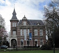
Dongen - Hoge Ham

Dongen, Kerkstraat, Kunstpodium

Donge

Supermarkt in 's Gravenmoer


References[edit]
- ^ "Burgemeester René (M.F.A.) van Diessen" (in Dutch). Gemeente Dongen. Archived from the original on 12 May 2014. Retrieved 10 May 2014.
- ^ "Kerncijfers wijken en buurten 2020" [Key figures for neighbourhoods 2020]. StatLine (in Dutch). CBS. 24 July 2020. Retrieved 19 September 2020.
- ^ "Postcodetool for 5104JJ". Actueel Hoogtebestand Nederland (in Dutch). Het Waterschapshuis. Retrieved 10 May 2014.
- ^ "Bevolkingsontwikkeling; regio per maand" [Population growth; regions per month]. CBS Statline (in Dutch). CBS. 1 January 2019. Retrieved 1 January 2019.
External links[edit]
 Media related to Dongen at Wikimedia Commons
- Official website
Places adjacent to Dongen | |
|---|---|

| General | |
|---|---|
| National libraries | |
| Other | |
This North Brabant location article is a stub. You can help Wikipedia by expanding it. |
No comments:
Post a Comment