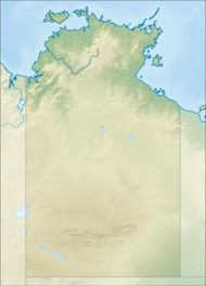
Watarrka National Park
| Watarrka National Park Petermann[1], Northern Territory | |
|---|---|
 | |
| Nearest town or city | Yulara |
| Coordinates | 24°16′47″S 131°33′30″E / 24.27972°S 131.55833°ECoordinates: 24°16′47″S 131°33′30″E / 24.27972°S 131.55833°E |
| Established | 31 July 1989[2] |
| Area | 1,051.85 km2 (406.1 sq mi)[2] |
| Visitation | 257,500 (in 2018)[3]:3[4] |
| Managing authorities | Parks and Wildlife Commission of the Northern Territory |
| Website | Watarrka National Park |
| See also | Protected areas of the Northern Territory |
Watarrka National Park is a protected area in the Northern Territory of Australia located about 1,316 kilometres (817 miles)[citation needed] south of the territory capital of Darwin and 323 kilometres (200 miles) southwest of Alice Springs.[3]:3
It contains the much visited Kings Canyon at the western end of the George Gill Range and Kathleen Springs—22 kilometres (13 miles) to the southeast of Kings Canyon.[citation needed]
Watarrka National Park was established in 1989 and gets its name from the Aboriginal name of the land.[citation needed]
In 1986, the national park was described as follows:[5]
One of the most spectacular canyons in Central Australia. Kings Canyon contains some 60 rare or relict plant species and a total of 572 different plant species and 80 species of birds. It is a 'living plant museum' and is notable for its stands of cycads & permanent rock pools. There are some well-preserved Aboriginal paintings and engravings in the area...
The national park is categorised as an IUCN Category II protected area.[2] On 25 March 1986, it was listed on the now-defunct Register of the National Estate.[5][6]
See also[edit]
References[edit]
- ^ "Petermann". NT Atlas and Spatial Data Directory. Northern Territory Government. Retrieved 19 June 2019.
- ^ a b c d "CAPAD 2012 Northern Territory Summary (see 'DETAIL' tab)". CAPAD 2012. Australian Government - Department of the Environment. 7 February 2014. Retrieved 7 February 2014.
- ^ a b WATARRKA NATIONAL PARK JOINT MANAGEMENT PLAN July 2018 (PDF). Traditional Owners and Parks and Wildlife Commission of the Northern Territory. July 2018. p. 3. ISBN 9781743501429.
- ^ "Park visitor data". Department of Tourism Sport and Culture. Northern Territory Government. Retrieved 19 June 2019.
...Traffic counters located along Luritja Road at two separate entry points...
- ^ a b "Watarrka (Kings Canyon) National Park, Ernest Giles Rd, Yulara (sic), NT, Australia - listing on the now-defunct Register of the National Estate (Place ID 190)". Australian Heritage Database. Department of the Environment. 25 March 1986. Retrieved 19 June 2019.
- ^ "COMMONWEALTH OF AUSTRALIA Australian Heritage Commission Act 1975 NOTICE OF ENTRY IN THE REGISTER OF THE NATIONAL ESTATE". Commonwealth Of Australia Gazette. Special (S127). Australia, Australia. 25 March 1986. p. 25. Retrieved 20 June 2019 – via National Library of Australia.
Kings Canyon National Park, …72,400 ha, located 325 km west of Alice Springs
 This article incorporates text by Commonwealth of Australia available under the CC BY 3.0 AU licence.
External links[edit]
| Wikimedia Commons has media related to Watarrka National Park. |
| Wikivoyage has a travel guide for Watarrka National Park. |
| This Northern Territory geography article is a stub. You can help Wikipedia by expanding it. |
| This Australian protected areas-related article is a stub. You can help Wikipedia by expanding it. |

No comments:
Post a Comment