Millingen aan de Rijn
Jump to navigation Jump to search

Millingen aan de Rijn | |
|---|---|
Town and former municipality | |
.JPG) Church in Millingen aan de Rijn | |
 Flag Coat of arms | |
.svg) Location in Gelderland | |
| Coordinates: 51°52′N 6°3′E / 51.867°N 6.050°ECoordinates: 51°52′N 6°3′E / 51.867°N 6.050°E | |
| Country | Netherlands |
| Province | Gelderland |
| Municipality | Berg en Dal |
| Area | |
| • Total | 10.27 km2 (3.97 sq mi) |
| • Land | 8.66 km2 (3.34 sq mi) |
| • Water | 1.61 km2 (0.62 sq mi) |
| Elevation | 13 m (43 ft) |
| Population (August 2017) | |
| • Total | 5,918 |
| Time zone | UTC+1 (CET) |
| • Summer (DST) | UTC+2 (CEST) |
| Postcode | 6566 |
| Area code | 0481 |
| Website | www |
Millingen aan de Rijn (Dutch pronunciation: [ˈmɪlɪŋə(n) aːn də ˈrɛin] (![]() listen)) is a former municipality and a town in the eastern Netherlands, in the municipality of Berg en Dal (formerly known as Groesbeek).
listen)) is a former municipality and a town in the eastern Netherlands, in the municipality of Berg en Dal (formerly known as Groesbeek).
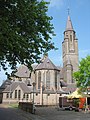
Sint Antonius Church

References[edit]
- ^ "Kerncijfers wijken en buurten 2020" [Key figures for neighbourhoods 2020]. StatLine (in Dutch). CBS. 24 July 2020. Retrieved 19 September 2020.
- ^ "Postcodetool for 6566EG". Actueel Hoogtebestand Nederland (in Dutch). Het Waterschapshuis. Archived from the original on 21 September 2013. Retrieved 10 July 2014.
External links[edit]
 Media related to Millingen aan de Rijn at Wikimedia Commons
- Official website
This Gelderland location article is a stub. You can help Wikipedia by expanding it. |
No comments:
Post a Comment