Roerdalen
Jump to navigation Jump to search
This article may be expanded with text translated from the corresponding article in Dutch. (July 2012) Click [show] for important translation instructions.
|
Roerdalen Roerdale | |
|---|---|
 Church in Melick | |
 Location in Limburg | |
| Coordinates: 51°9′N 6°0′E / 51.150°N 6.000°ECoordinates: 51°9′N 6°0′E / 51.150°N 6.000°E | |
| Country | Netherlands |
| Province | Limburg |
| Established | 1 January 1991 |
| Government | |
| • Body | Municipal council |
| • Mayor | Monique de Boer-Beerta (VVD) |
| Area | |
| • Total | 88.79 km2 (34.28 sq mi) |
| • Land | 88.21 km2 (34.06 sq mi) |
| • Water | 0.58 km2 (0.22 sq mi) |
| Elevation | 28 m (92 ft) |
| Population (January 2019)[4] | |
| • Total | 20,615 |
| • Density | 234/km2 (610/sq mi) |
| Time zone | UTC+1 (CET) |
| • Summer (DST) | UTC+2 (CEST) |
| Postcode | 6060–6065, 6074–6077 |
| Area code | 0475 |
| Website | www |
Roerdalen (Dutch: [ruːrˈdaːlə(n)] (![]() listen); Limburgish: Roerdale) is a municipality in the southeastern Netherlands, in the province of Limburg. As of 2007, it had about 21,000 inhabitants and borders Germany.
listen); Limburgish: Roerdale) is a municipality in the southeastern Netherlands, in the province of Limburg. As of 2007, it had about 21,000 inhabitants and borders Germany.
Population centres[edit]
- Herkenbosch
- Melick
- Montfort
- Posterholt
- Reutje
- Sint Odiliënberg
- Vlodrop
Topography[edit]
Dutch Topographic map of the municipality of Roerdalen, June 2015
Notable people[edit]
- Hubert Biermans (1864 in Herkenbosch - 1953) a Dutch and Canadian businessman
- Connie Palmen (born 1955 in Sint Odiliënberg) a Dutch author
- Geert Chatrou (born 1969 in Sint Odiliënberg) a professional whistler
- Jos Verstappen (born 1972 in Montfort) a Dutch former racing driver
- Joeri Verlinden (born 1988 in Melick) a Dutch swimmer, competed at the 2016 Summer Olympics
Gallery[edit]
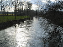
River Roer
References[edit]
- ^ "Samenstelling college B&W" [Members of the board of mayor and aldermen] (in Dutch). Gemeente Roerdalen. Retrieved 21 November 2013.
- ^ "Kerncijfers wijken en buurten 2020" [Key figures for neighbourhoods 2020]. StatLine (in Dutch). CBS. 24 July 2020. Retrieved 19 September 2020.
- ^ "Postcodetool for 6077CG". Actueel Hoogtebestand Nederland (in Dutch). Het Waterschapshuis. Retrieved 21 November 2013.
- ^ "Bevolkingsontwikkeling; regio per maand" [Population growth; regions per month]. CBS Statline (in Dutch). CBS. 1 January 2019. Retrieved 1 January 2019.
External links[edit]
 Media related to Roerdalen at Wikimedia Commons
- (in Dutch) Official website


No comments:
Post a Comment